Green Map of Easton
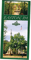 IN PARTNERSHIP with the Easton Environmental Advisory Council, students in the seminar Mapping Urban Ecology, taught by Bonnie Winfield, director of the Landis Community Outreach Center, created a web-based “open green map” of Easton, showing bike trails, walking trails, greenways, parks, scenic views and byways, waterways, transportation facilities, environmental amenities, and other features. It is designed as a method of public education about these features and as a tool for navigation. With the help of John Wilson, lab coordinator in the geology department, the map has been transformed into a printed map and is available in the city.